Copley Community Orchard
Gladstone CreekGladstone Creek
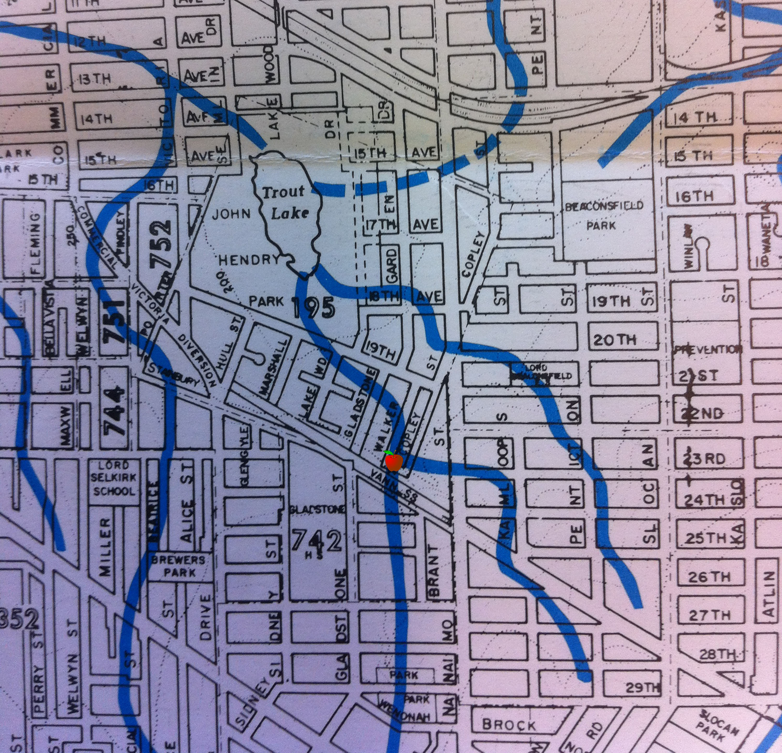
This map is from the book Vancouver’s Old Streams. It shows the natural drainage of Vancouver, as it was before the City was built. An apple is placed where Copley Community Orchard is located. (Click on the map to see more details).
by: Meredith A.Brown
“Trout Lake, the headwaters of China Creek, once had three streams flowing into it, the largest being Gladstone Creek (Proctor 1989). The area around Trout Lake was a peat bog surrounded by a hemlock forest.
In 1926, the land around Trout Lake became the property of the Vancouver Parks Board and the water level of the lake was lowered to connect with the sewer and to create safe swimming beaches. (Trout Lake Restoration Committee 1995).
In the 1930s and 40s frequent peat fires burned around the Trout Lake. The peat was eventually drained from the bog surrounding the Lake. . .
As East Vancouver grew, the watershed was deforested and paved.”
Memories of Gladstone Creek: “When I was young, I attended Sunday School at that church across Victoria from Cedar Cottage Neighbourhood House, when it was Cedar Cottage United Church, I think it had a beautiful house at the south end of Copley Street fairly close to the Central Park tram trestle. In fact, when that house was built, the trams may have been running at grade before the trestle was built.
The Greer house would have looked out over Gladstone Creek that ran between Copley Street and Walker Street on its way to Trout Lake. Any traces of the creek are long gone.”
Trout Lake Community Crawl: “Gladstone Creek… was the site of a proposed project in 1995 in which the stream would be “daylighted” or brought to the surface to restore the park to a more natural state while providing a bountiful habitat for wildlife and plants. However, the creek is unfortunately too deep underground for that to be possible, and will thus remain a hidden secret known only to those willing to learn about it.”